General information
The “Apagoregomeno” hiking trail is 2.4 km long and can be completed in 25 minutes. This hike has a low degree of difficulty and doesn’t need any special hiking equipment. The hike starts from the village’s amphitheatre and leads through the forest until you reach a narrow, unpaved country road. On the way back you have two options: either follow the same path back to the village or follow one of the four recommended hikes that can be combined with the “Apagoregomeno” trail.
- Saint George and Apagoremeno hiking trail
- Apagoremeno and vineyard hiking trail
- Apagoremeno and Observatory hiking trail
- Parallel Observatory trail
- Distance: 1.2 km one way.
- Duration: 15 minutes.
- Difficulty: easy
- Hiking gear: hiking sandals, a water bottle, a hat
- Attractions: Amphitheatre, Apagoremeno trial, nice view
History
This foot path has been traditionally used by locals to go to work in the fields. Before the tractors became the norm, the villagers used horses, mules or donkeys to transport the tools needed for agriculture and harvesting purposes.
The footpath was restored in 2020 by a team of ESC-volunteers from the Filoxenia Youth Organisation, in collaboration with the local community, the Forest Office and the Culture Association of Kryoneri. It is currently used by both tourists, locals, as well as students doing sports training.
Natural landscape
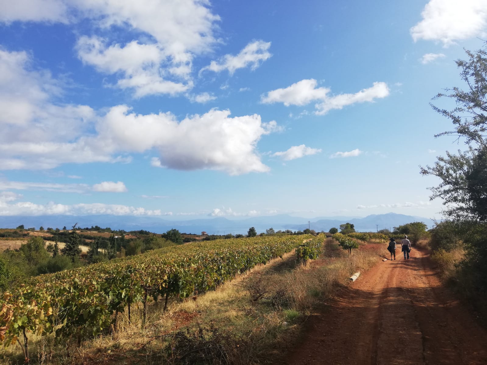
The first part of the trail goes through the forest, then it continues alongside vineyards, which stretch for many hectares. Once you reach the country lane, you have two options to return to the village: either follow the exact same path back on the main road or continue your hike uphill.
Along the footpath you can notice the beautiful red clay soils, which are excellent for vine crops, especially red vines. Clay soil benefits from high nutrients and can hold a high amount of water. Clay soils remain wet and cold in winter and dry out in summer. Every year, these fields produce a rich harvest of table grapes. They are either sold to supermarkets and other retailers in Greece and abroad or they are consumed by the local population.
There you can admire beautiful landscapes of a Mediterranean forest, as well as olive and vine orchards. In the distance, you can see the Astronomical Observatory, the village’s old cemetery with its majestic cypress trees, as well as the Corinthian Gulf.
The vegetation varies greatly depending on altitudes. The footpath starts at a 750 meters altitude, along the Elisson riverbank, flanked on each side by big tall trees. As you go uphill, you will find typical mediterranean vegetation along the road, of mixed forests of cypress trees, shrubs and stone pines. In autumn, after the seasonal rainfalls, the footpaths are sprinkled with greek cyclamen flowers and the landscape gains a fresh tint of green. This beautiful greenery is home to wild rabbits, foxes, wild pigs, snakes, lizards and turtles as well.