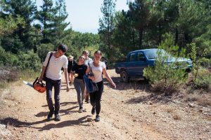
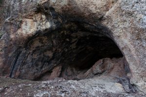
1. Memory Walk: Karamanos Hiking Trail
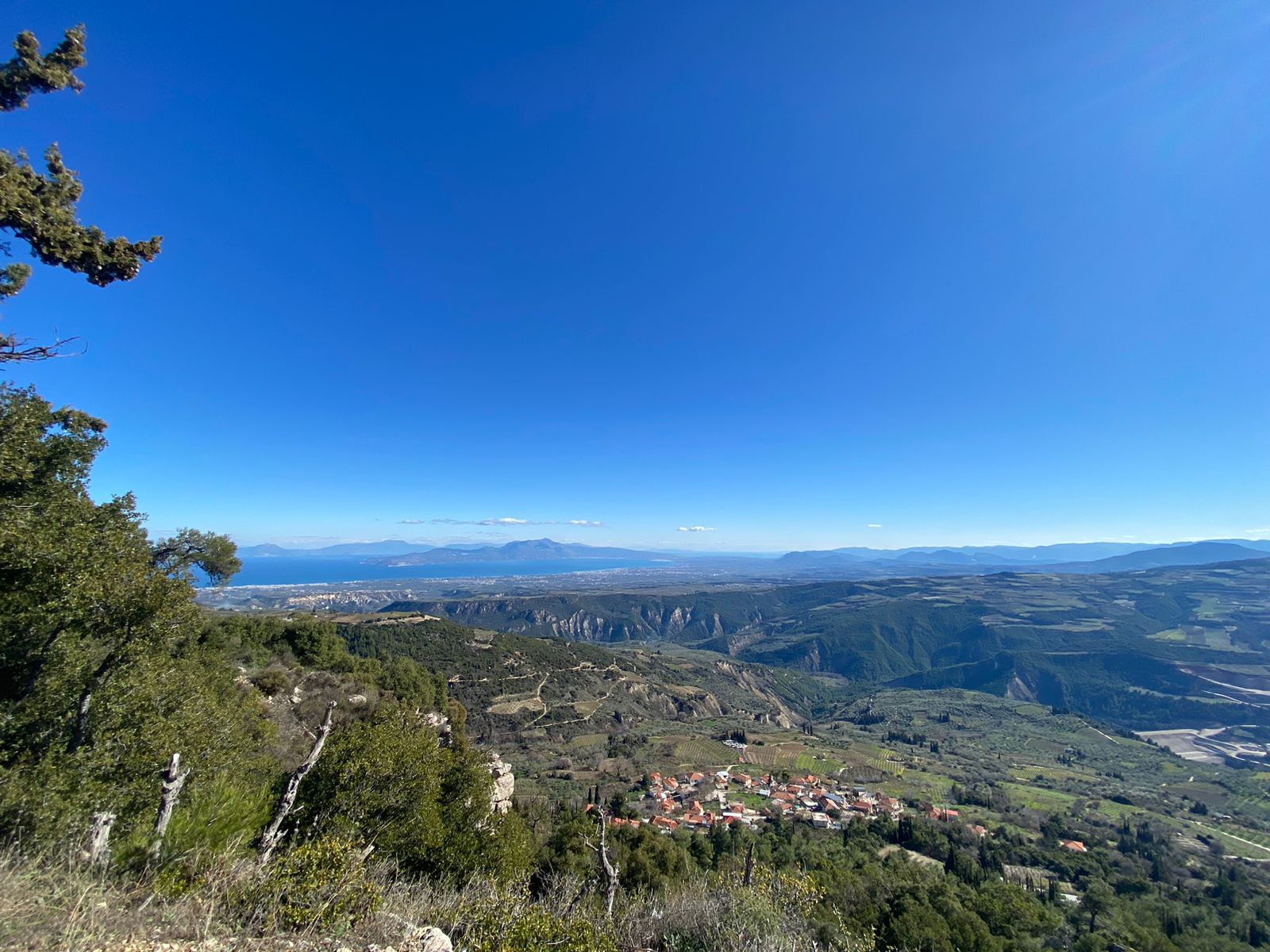
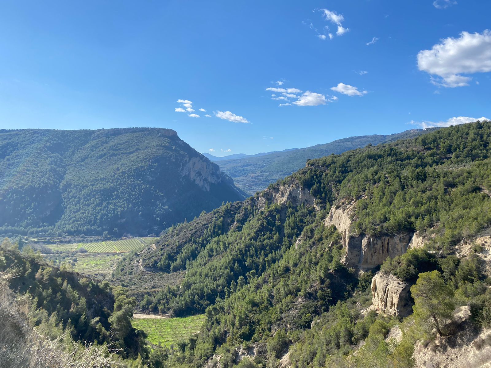
The Karamanos cave (842 m) is located on the slope of a forested hillside, 2 km away from the Kryoneri village. The Memory Walk: Karamanos hiking trail starts at the Amphitheatre, then continues uphill, giving you a marvellous glance over the Corinth Gulf. On the left, you can also see the Mount Parnassus, which in winter is covered in snow, in beautiful contrast with the blue of the sky and the sea.
- Distance: 6.31 km
- Duration: 1 hour 18 minutes
- Difficulty: medium
- Hiking gear: walking boots or hiking sandals, water bottle, a hiking hat, trekking poles (if you need extra support)
- Attractions: Polykentro, Church, Stumbling Stones, Amphitheatre, Karamanos Cave
2. Elisson River Trail
The Elisson River Trail runs along the Elisson River, which flows just below Kryoneri. When it is quiet you can hear the sound of the flowing water up in the village. This path descends to Kato Vrisi, a traditional 18th century fountain, located in the valley of the river Elissonas, which originates from Kryoneri and flows into the Corinthian Gulf in the town of Kiatos. The river is known since antiquity, flowing southeast in the middle of the village. The path offers amphitheatrical views of the village and panoramic views of the green valley of Elisson. Guests can enjoy a beautiful natural landscape with lush vegetation and towering century-old plane trees.
- Distance: 1.37 km
- Duration: 21 minutes
- Difficulty: medium
- Hiking gear: Hiking boots (waterproof)
- Attractions: Elisson River (very beatiful nature), Junction, Trinity church, Amphitheatre
3. Ancient Sicyon Hiking Trail
The Ancient Sicyon hiking trail is a hiking trail, with many meters of altitude, but goes downhill from Kryoneri most of the time.
It has a lot of nature and culture to offer and is therefore highly recommended. The beginning is in Kryoneri and the end point at the amphitheatre in Sicyon, the cradle of theatre, where the world’s first theatre was performed around 400-300 BC. In addition, in Sicyon there is also a historical museum, right next to the theatre.
- Distance: 12 km (one way)
- Duration: 150 minutes (one way)
- Difficulty: medium
- Hiking gear: walking boots or hiking sandals, water bottle, a hat, trekking poles (if you need extra support)
- Attractions: Amphitheatre, fantastic view, Ancient city Sicyon
4. The Apagoremeno Hiking Trail
The Apagoremeno hiking trail is 2.4 km long and can be completed in 25 minutes. This hike has a low degree of difficulty and doesn’t need any special hiking equipment. The hike starts at the village’s Amphitheatre and takes you through the forest until you reach a narrow country lane, without asphalt. On the way back you have two options: either to follow the same path to return to the village or to go along the country lane in the direction of the village.
- Distance: 1.2 km one way.
- Duration: 15 minutes.
- Difficulty: easy
- Hiking gear: hiking sandals, a water bottle, a hat
- Attractions: Amphitheatre, Apagoremeno trial, nice view
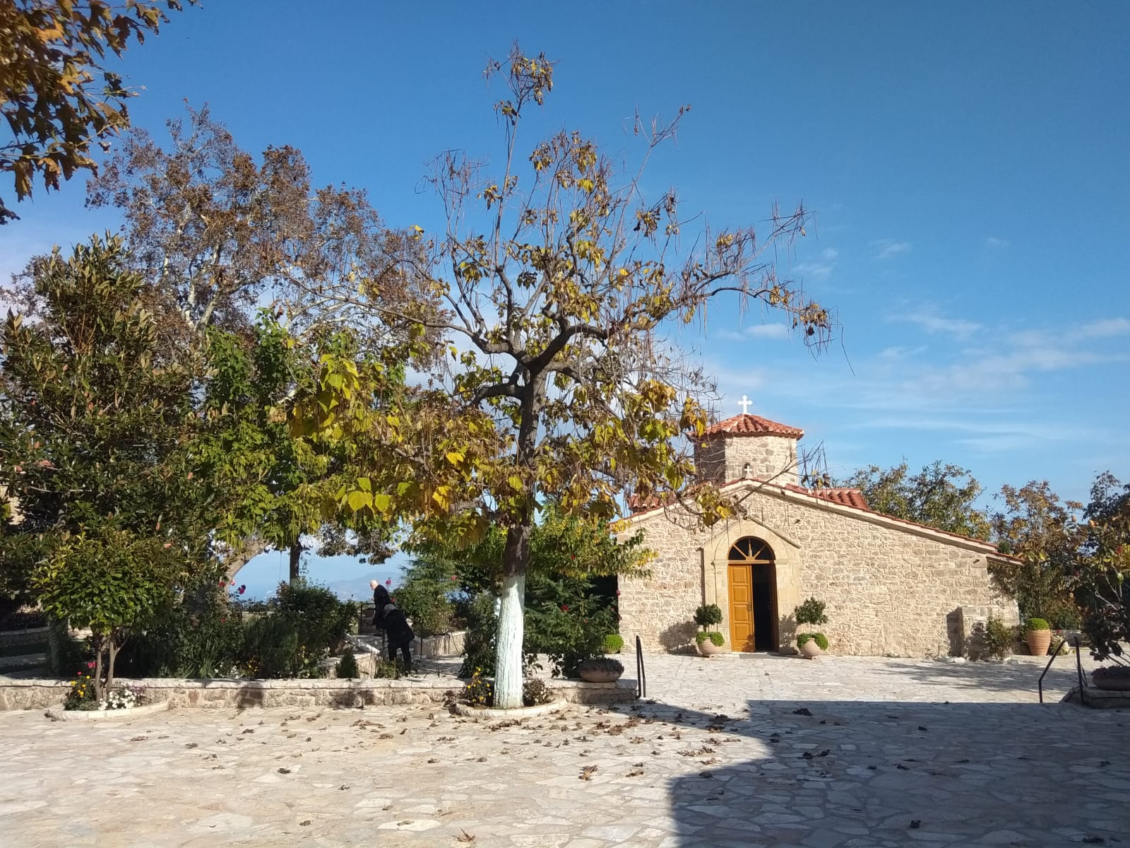
5. St. George and Apagoremeno Hiking Trail
The St. George and Apagoremeno hiking trail leads through the vineyards of Kryoneri to the Saint George church. The Saint George Church is a beautiful little church from which you have an amazing view over the Gulf of Corinth and the gorge stretching at the foot of the mountain.
- Distance: 4,65 km
- Difficulty: medium
- Duration: 60 minutes
- Hiking gear: Water bottle, a hat, hiking shoes, trekking poles (if you need extra support)
- Attractions: The Church of Saint George, The Little Church in Kryoneri and the vineyards
6. Apagoremeno and Vineyard Hiking Trail
The Apagoremeno and vineyard hiking trail leads through the vineyards to the Stymphalia-plateau with a nice view over the valley and the mountains in the background.
- Distance: 7.6 km
- Duration: 80 minutes
- Difficulty: easy
- Hiking gear: walking boots or hiking sandals, water bottle, a hat, trekking poles (if you need extra support)
- Attractions: Amphitheatre, Apagoremeno hiking trail, Observatory, panoramic view
7. Apagoremeno and Observatory Hiking Trail
The Apagoremeno and Observatory hiking trail leads through the vineyards in the northeast of Kryoneri to the Kryoneri Observatory. The Astronomic station of Kryoneri was established in 1972 at an altitude of 1,000 meters, on top of mount Kyllini, covering a surface of 65 acres (later expanded to 105 acres). The Station is located in the Corinth District, northern Peloponnese, only 22 kilometers away from the nearest town, Kiato. The Station has a 1.2 m Cassegrain reflector telescope, installed in 1975, which is currently one of the largest telescopes in Greece and in the Balkans.
- Distance: 6.8 km
- Duration: 70 minutes
- Difficulty: Medium
- Hiking gear: Walking boots or hiking sandals, water bottle, a hat, trekking poles (if you need extra support)
- Attractions: Amphitheatre, Observatory, little Church
8. Parallel Observatory Trail
The Parallel Observatory Trail starts from the end of the Apagoremeno hiking trail and leads through the vineyards above the village. As the name might suggest, the trail leads parallel to the Observatory hiking trail. So you can see the Observatory at some points. It will lead you to a Junction, where you can see the pllateau of the end of which lies Stymphalia.
- Distance: 2 km
- Duration: 30 minutes
- Difficulty: easy
- Hiking gear: walking boots or hiking sandals, water bottle, a hat, trekking poles (if you need extra support)
- Attractions: Observatory, view over plateau
9. Junction to Hostel Elisson
This short hiking trail can be seen as a shortcut to get from the Junction to the Hostel Elisson. The Junction to Hostel Elisson trail partially overlaps with the Elisson River hiking trail which means that it leads through Kryoneri’s stunning nature.
- Distance: 550 meters
- Duration: 10 minutes
- Difficulty: medium
- Hiking gear: walking boots, waterproof hiking shoes, trekking poles (if you need extra support)
- Attractions: Junction, Shepperds cave, Elisson river
10. Junction to Amphitheatre
The Junction to Amphitheatre trail is a way to get from the junction to the village. This path is characterized by a fantastic view through the valley to the Gulf of Corinth. The trails leads past the cemetery, through the village, past the Trinity Church and then back to the Amphitheatre.
- Distance: 1.5 km one way.
- Duration: 20 minutes.
- Difficulty: easy
- Hiking gear: hiking boots, water bottle.
- Attractions: view over the valley, cemetry, Trinity church and the Amphitheatre.
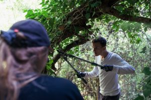
11. Junction to the Olive Oil Press Hiking Trail
This trail, like many others, starts at the Junction. It has to offer very impressive rockformations, the Elisson river, a very old bridge, an old abandoned mill and the olive oil press. The olive oil press is open from october till the end of january, for the local farmers to have their olive oil pressed there. The annual olive production is about 320,000 tones, harvested from more than 55,000 thousand trees in the region around Kryoneri.
- Distance: 5.1 km
- Duration: 60 minutes
- Difficulty: easy
- Hiking gear: Walking boots or hiking sandals, water bottle, a hat, trekking poles (if you need extra support)
- Attractions: Junction, big rock formations, Olive oil press, Pirona fountain, Amphitheatre
12. The Lechova Hiking Trail
The Lechova Hiking Trail overlaps with the Karamanos trail and can be a nice day hike. You can see the Karamanos Cave, a beautiful church with a view, the Lechova Monastery and then walk back to Kryoneri via a beautiful fled path to the amphitheatre.
- Distance: 10 km
- Duration: 150 minutes.
- Difficulty: medium
- Hiking gear: walking boots, water bottle, a hatt, trekking poles (if you need extra support)
- Attractions: Karamanos Cave, Lechova Monastery, Amphitheatre.
13. Prophet Elias Church Hiking Trail
The Prophet Elias church hiking trail partially overlaps with the Lechova Monastery hiking trail. But the destination is the Prophet Elias church which offers a fantastic view. You can even take a look from above at the construction site where a dam is being built.
- Distance: 10.7km
- Duration: 120 minutes
- Difficulty: medium
- Hiking gear: walking boots or hiking sandals, water bottle, a hat, trekking poles (if you need extra support)
- Attractions: Amphitheatre, Karamnos cave, Prophet Elias church, view over the valley, view on the dam
14. The Mongustos Trail
The Mongustos trail is by far the longest trail and leads through the Mongustos Forest. At the end you will arrive at a viewing platform from where you have a fantastic view over the Gulf of Corinth, Xylokastro and to Trikala.
- Distance: 19 km
- Duration: 4-5 hours
- Difficulty: medium
- Hiking gear: walking boots or hiking sandals, water bottle, a hat, trekking poles (if you need extra support)
- Attractions: Amphitheatre, Observatory, Mongustos Forest, panoramic view
15. The Pirona Hiking Trail
The Pirona hiking trail comprises of various sceneries, from plain fields to heavy populated forests and the path runs mostly along the river, where one can enjoy the pleasant shade. The Trail leads along the Lechova River, which has its spring at the monastery. Close to the Junction is an old archbridge that leads to the other side of the river, where also the hiking trail continues.
- Distance: 3.5 km
- Duration: 1 hour and 20 minutes
- Difficulty: medium
- Hiking Gear: walking boots, a water bottle, a hat, sturdy waterproof hiking shoes, trekking poles (if you need extra support)
- Attractions: Pirona fountain, ancient bridge